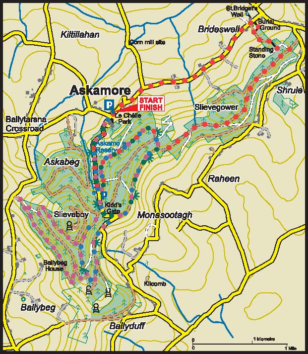
ASKAMORE
ASKAMORE LOOP
Distance: 6km (3.7 miles)
Ascent: 280m/160m
Walking time: 1hr 30min
Waymarking: Green
Grade: Moderate
BALLYBEG LOOP
Distance: 9km (5.6 miles)
Ascent: 280m/160m
Walking time: 2hr 30min
Waymarking: Blue
Grade: Moderate
SLIEVEBOY LOOP
Distance: 12km (7.5 miles)
Ascent: 360m/300m
Walking time: 3hr 30min
Waymarking: Purple
Grade: Moderate
ST BRIGID’S LOOP
Distance: 10km (6.2 miles)
Ascent: 360m/300m
Walking time: 3hr
Waymarking: Red
Grade: Moderate
OSI Discovery Map Series 69
GRID REFERENCE: T 028 590
SAT NAV: 52.672, -6.479
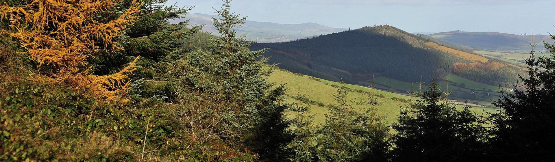
These four walks, all beginning from the trailhead in the car park in quiet Askamore village, make up the Askamore Loop. Individually waymarked, the walks all begin by following a minor road which brings you uphill through scenery reminiscent of an Austrian valley, with trees sweeping below you, and wonderful views to the Wicklow Hills and beyond. Entering the wooded section of the walk to the left will eventually reveal the Co. Wexford coast, allowing breath-taking views north to the sea-based windmills on the Arklow sandbanks, east to Kilmuckridge and south to Enniscorthy, New Ross and Wexford in the distance. Bring your binoculars to spot the ferries leaving Rosslare. The trail divides on top, sending you back along Sliabh Gower on the new St. Brigid’s Loop, and along the road into the village once more. Further along the original track, following the Askamore Loop will bring you down the hill road and back to the village. The Ballybeg and Slieveboy walks continue down the road to the left and re-enter on the slopes of Sliabh Bhuí, the Yellow Mountain. Now you can see as far as medieval Ferns and across to Mount Leinster and the renowned Blackstairs Mountains. If you’re feeling up to it, an unmarked path will take you to the summit at 420m. The routes divide and rejoin to bring you back to the trailhead in Askamore.
DON’T MISS
- Askamore’s thriving rural community opened a new park in 2013 as part of its local development. This includes a lit walkway around a playground, picnic area, adult gym and a seven-circuit classical labyrinth. Walk, play, meditate, chat, eat – you’re welcome to join us.
- Other local sites include a famine graveyard and the site of one of the battles of 1798 in Ballyellis, where a rare rebel victory occurred on June 30th, nine days after the Battle of Vinegar Hill.
- Coffee shops and other services in the heritage town of Carnew, 4.5km away.
- Watch out for fallow deer, particularly on the first section of these walks. These loops are a must for those interested in wonderful scenery with stunning views across Counties Wexford and Wicklow.
Check out www.askamore.com for further local information.
GETTING HERE
Directions: From Gorey: Follow the R725 in the direction of Carnew for 6.5 km. Left into Craanford (L-1021), right onto L-1013 after 1.7 km, left on to L-1015 after 3.3 km. Trailhead in Askamore church carpark after 3.2 km. From Ferns: Take Carnew road R745 (turn at Doyle’s Pub) and follow for 10 km. Turn right at Byrne’s machinery breakers. Follow L-1015 for 1.6 km to Askamore.