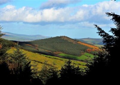
Annagh Hill
Turnaround Trail
Grade: moderate
Distance: 8.5km
Waymarking: Blue
Trailhead: Car park at The Gap Pub
Sat Nav: 52.763265, -6.359776
Parking: Free car park at The Gap Pub

Trail Description
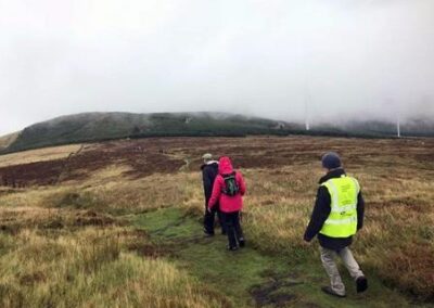
The trail starts out from the car park of The Gap Pub, following the same path as the Yellow Belly Trail. This trail then splits in the forest as it turns back towards the Trailhead and The Yellow Belly Loop ascends around Annagh Hill. The trails join together again on the final ascent back to the trailhead.
Don’t Miss…
- The comfortable setting of the hospitable and atmospheric Gap Country Pub where you will hear tall tales and short stories from an eclectic mix of locals. Don’t worry if you have one too many, Seán will drive you to your accommodation.
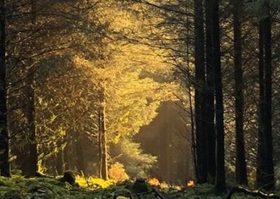
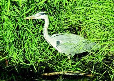
- The opportunity to wonder at the grace and beauty of the birds of prey that hover over the woods and moorland in expectation of a tasty meal. Buzzards, kites and hawks are common and also keep an eye out for the occasional deer dashing through the undergrowth.
Useful Trail Information
OSI Discovery Map Series 62
Grid Reference: T 10753 69258
Ascent: 202 metres
Walking time: 160 minutes
Format: Loop
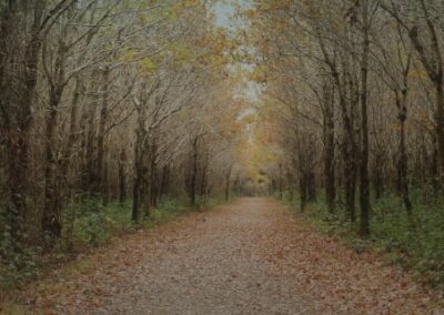
Surface: mixed
Gates/Stiles:
Start/Finish: The Car Park at The Gap Pub
Equipment Recommended: Specific outdoor walking footwear and clothing required.
Other Useful Information
Mobile Coverage:
Picnic Area:
Public Toilets:
Dogs: Dogs must be kept under control at all times.
You must clean up after your dog if it fouls in a public place.
Public Transport:

Nearby Walking Trails
Getting Here
On the M11 from Dublin or Wexford take exit 22 towards (Gorey, Inch). Take the first exit off the western roundabout and first immediate right turn directly opposite Greens Berry Farm. Follow straight through Kilanerin village towards Pallas. (approximatley 5km). At the Ballyfad signpost keep left, then continue straight on over the bridge until the next T junction, then take a right. Continue until you come to The Gap Pub on the right. The car park is on the left.
![]() These trails are located in Coillte owned forests.
These trails are located in Coillte owned forests.
Wexford Walking Trails clg appreciates the support and co-operation of Coillte under their Open Forest Policy.

Trail Grades
Trail grades give an indication of what to expect when out on a trail. The grade will give an idea of the level of fitness and ability required to use the trail.
Before attempting a trail, it is important to consider the grading to ensure it matches your ability and level of fitness.
Wexford Walking Trails are graded by Sport Ireland according to their criteria which is explained here.
Multi-Access
Flat smooth trails, suitable for all users including people with reduced mobility, wheelchair users, people with a vision impairment, using crutches, with a buggy, with small children, older people and so on. Normal outdoor footwear can be worn. Source : Sport Ireland
Moderate
These trails may have some climbs and may have an uneven surface where the going is rough underfoot with some obstacles such as protruding roots, rocks, etc. The routes are appropriate for people with a moderate level of fitness and some walking experience. Specific outdoor walking footwear and clothing is recommended. Source : Sport Ireland
Easy
Generally flat trails with a smooth surface and some gentle slopes or shallow steps. These trails are generally suitable for family groups including children and older people. Normal outdoor footwear can be worn. Source : Sport Ireland
Strenuous
These are physically demanding trails, which will typically have some sections with steep climbs for long periods and the going underfoot can be extremely rough including many obstacles. Suitable for users accustomed to walking on rough ground and with a high level of fitness. Specific outdoor walking footwear and clothing required. Source : Sport Ireland