Cahore Point Trail
Grade: Easy
Distance: 4.8km (3 miles)
Waymarking: Red
Trailhead: Cahore Pier
Sat Nav: 52.569 -6.202
Parking: Cahore Pier and Oldbawn Beach

Trail Description
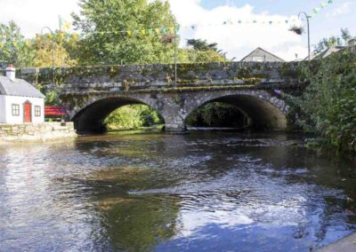
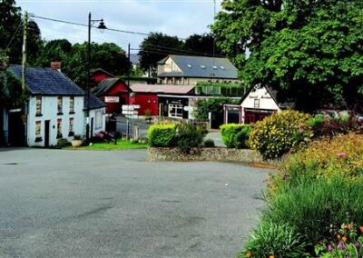
Located in the heartland of an old Gaelic Stronghold called ‘The Macamores’, Cahore is a hidden gem on the east coast of County Wexford
The cliff walk caters for recreational users of all abilities and it looks out over the Irish Sea. It begins at the pier which is a popular location for both visitors and locals alike. Along the walk there are many points of interest such as stone lookout towers, Cahore Castle, the remains of a WW2 Éire sign and some interesting rock formations including some amazing contorted strata. The trail then leads onto the sandy South Beach just behind Cahore Castle. This golden sand is the starting point of one of the largest stretches of sandy beaches in Ireland which continues all the way past Morriscastle towards Curracloe and the Raven to the south. This beach is bordered by natural sand dunes and these form part of the Cahore Polders and the Dunes National Heritage Area.
The dunes are of high conservation value for wintering waterfowl, in particular the Greenland white-fronted goose, golden plover, lapwing and wigeon. The geese use the site as a feeding area, commuting every day from Wexford harbour. The area also has a population of newts while the common lizard is found in the dunes to the south. These dunes are also home to the gatekeeper butterfly, rabbits and the little tern. The trail then leaves the beach and goes inland, taking you back to the village of Cahore.
Don’t Miss…
- Watch the fishing and leisure boats which launch off the pier in the summer months
- Look out for seals which can be spotted occasionally at the pier, especially in winter when locals go fishing for herring.
- Watch anglers fishing along the rocky and sandy shoreline or the children who fish for crabs at the
small bridge by the pier - Enjoy the stunning beaches that stretch to Morriscastle and the Raven in Curracloe
- Observe the wild geese flying in from Wexford Harbour to feed in the dunes
- Listen for the tern nesting in the sand and hearing the curlew cry in the dunes
- Look for the motte off in the distance at Glascarrig Point
- Find a small piece of coal washed up on the beaches from shipwrecks off the Blackwater Bank
- Cahore and Cahore South beach are Green Coast beaches
- And not forgetting, the amazing sunrises!
Useful Trail Information
OSI Discovery Map Series: 69
Grid Reference: T219 479
Ascent: 10m
Walking time: 1 hour
Format: Loop
Surface: Mixed surfaces
Gates/Stiles: Yes
Start/Finish: Cahore Pier
Other Useful Information
Equipment Recommended: Specific outdoor walking footwear and clothing is recommended for a moderate grade trail.
Mobile Coverage: Generally Good
Picnic Area:
Public Toilets: Cahore Pier
Dogs: Dogs must be kept under control at all times. You must clean up after your dog if it fouls in a public place.
Public Transport:


Getting Here
From Gorey: Take the R742 in the direction of Courtown, continuing through Courtown to Ballygarrett village. Turn left on the main st and continue for 2km to Cahore. (17km approx. from Gorey)
From Wexford: Take the R741 over the bridge in Wexford town in the direction of Gorey. Shortly after you pass Wells House, take the right turn for Kilmuckridge village. At the T-junction in the village turn left and continue to Ballygarrett village. In the village turn right after the church, continuing for 2km to Cahore. (40Km approx. from Wexford town)

Trail Grades
Trail grades give an indication of what to expect when out on a trail. The grade will give an idea of the level of fitness and ability required to use the trail.
Before attempting a trail, it is important to consider the grading to ensure it matches your ability and level of fitness.
Wexford Walking Trails are graded by Sport Ireland according to their criteria which is explained here.
Multi-Access
Flat smooth trails, suitable for all users including people with reduced mobility, wheelchair users, people with a vision impairment, using crutches, with a buggy, with small children, older people and so on. Normal outdoor footwear can be worn. Source : Sport Ireland
Moderate
These trails may have some climbs and may have an uneven surface where the going is rough underfoot with some obstacles such as protruding roots, rocks, etc. The routes are appropriate for people with a moderate level of fitness and some walking experience. Specific outdoor walking footwear and clothing is recommended. Source : Sport Ireland
Easy
Generally flat trails with a smooth surface and some gentle slopes or shallow steps. These trails are generally suitable for family groups including children and older people. Normal outdoor footwear can be worn. Source : Sport Ireland
Strenuous
These are physically demanding trails, which will typically have some sections with steep climbs for long periods and the going underfoot can be extremely rough including many obstacles. Suitable for users accustomed to walking on rough ground and with a high level of fitness. Specific outdoor walking footwear and clothing required. Source : Sport Ireland