Three Rocks Trail 
Grade: Moderate
Distance: 13km (8 miles)
Waymarking: Navy
Trailhead: Ferrycarrig or Skeaterpark
Sat Nav:
Ferrycarrig Trailhead: 52.3517, -6.5094
Skeaterpark Trailhead: 52.293, -6.580
Parking: At the trailheads and at intervals across the route.

Trail Description
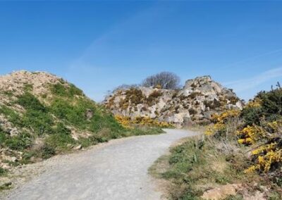
Take time to make your way along the Three Rocks Trail, among landmarks and landscape, from Ferrycarrig to Barntown and over Forth Mountain to find breath-taking scenery, biodiversity, and stories of bravery. Three Rocks Trail leads you along part of the route traversed by the Wexford men during the 1798 Rebellion in Wexford, while you are immersed in scenic beauty. A little adventure goes a long way!
Caution: Interaction with horses at various points along the walking trail.
Don’t Miss…
- Medieval castles and monuments that mark the way
- The lost town of Carrig
- 1798 Rebellion attack site, battlefield, campsite and burial site
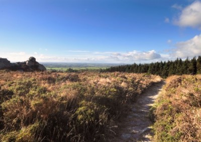
- The stunning views across the Wexford countryside
- Carrigfoyle Quarry
Useful Trail Information
OSI Discovery Map Series 77
Grid Reference: SL 930 822
Ascent: 205 metres
Walking time: 3.5 to 4 hours
Format: Linear
Surface: Combination or road, footpath and Hardcore path
Gates/Stiles: Chicane stiles in place at intervals along the trail
Start/Finish: Ferrycarrig/Skeaterpark
Equipment Recommended: Specific outdoor walking footwear and clothing is recommended for a moderate grade trail.
Other Useful Information
Mobile Coverage: Generally Good
Picnic Area: Yes (Carrigfoyle Lake Car Park)
Public Toilets: Yes (Beside Carrigfoyle Lake)
Dogs: Dogs must be kept under control at all times. You must clean up after your dog if it fouls in a public place.
Public Transport: There are regular buses from the centre of Wexford town that stop at the New Ross Road Roundabout on the outskirts of town where you can pick up the Three Rock Trail.

")
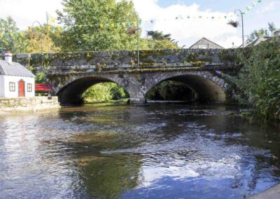
- Ferrycarrig Castle (16th century) and Bridge
- The Crimean War Monument / Round Tower (1858)
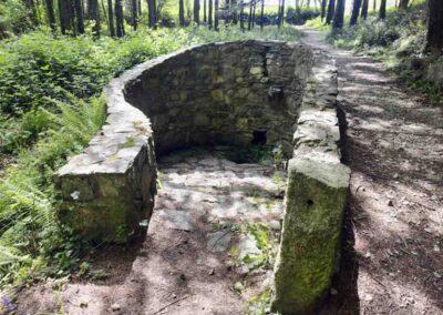
- Lost Town of Carrig
- Carrig Church and Graveyard –
- 1798 Attack Site
- Barntown Castle (16th century)
- Barntown Schools and Community Hall (1871-1989)
- St Alphonsus Church Barntown (1848)
- The Village with Old School & Church
- The Three Rocks 1798 Campsite
- Carrigfoyle/ Windgap Quarry
- Three Rocks Battle Site
- 1798 Militia Burial Site
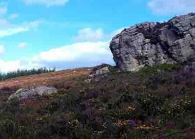
- Carrigfoyle Rock (Cliff Rock)
- Carrigshinna Rock (Rock of the Fox)
- Drooping Rock
- Clourane (Thistle top)
- The Raven Rock
- Jim Furlong’s House
- Skeater Rock (Bushy Summit)
- Carrigatinna Rock (Rock of Fire)
- Skeaterpark Trailhead
Nearby Walking Trails
Getting Here
Ferrycarrig: The car park is between the bridge and the Ferrycarrig Hotel beside Ferrycarrig Castle on the N11 on the outskirts of Wexford town.
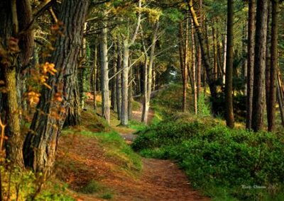
![]() These trails are located in Coillte owned forests.
These trails are located in Coillte owned forests.
Wexford Walking Trails clg appreciates the support and co-operation of Coillte under their Open Forest Policy.

Trail Grades
Trail grades give an indication of what to expect when out on a trail. The grade will give an idea of the level of fitness and ability required to use the trail.
Before attempting a trail, it is important to consider the grading to ensure it matches your ability and level of fitness.
Wexford Walking Trails are graded by Sport Ireland according to their criteria which is explained here.
Multi-Access
Flat smooth trails, suitable for all users including people with reduced mobility, wheelchair users, people with a vision impairment, using crutches, with a buggy, with small children, older people and so on. Normal outdoor footwear can be worn. Source : Sport Ireland
Moderate
These trails may have some climbs and may have an uneven surface where the going is rough underfoot with some obstacles such as protruding roots, rocks, etc. The routes are appropriate for people with a moderate level of fitness and some walking experience. Specific outdoor walking footwear and clothing is recommended. Source : Sport Ireland
Easy
Generally flat trails with a smooth surface and some gentle slopes or shallow steps. These trails are generally suitable for family groups including children and older people. Normal outdoor footwear can be worn. Source : Sport Ireland
Strenuous
These are physically demanding trails, which will typically have some sections with steep climbs for long periods and the going underfoot can be extremely rough including many obstacles. Suitable for users accustomed to walking on rough ground and with a high level of fitness. Specific outdoor walking footwear and clothing required. Source : Sport Ireland