The Ringwood (Kilcarbry)
Grade: Easy
Distance: 4km /2.5 miles
Waymarking: Red
Trailhead: Car Park at Sat Nav Co-Ords below
Sat Nav: 52.47198, -6.56772
Parking: Free Car park at Trailhead

Trail Description
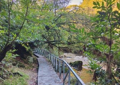
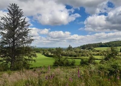
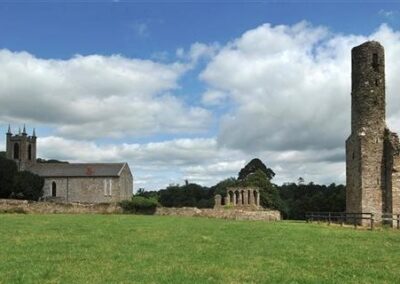
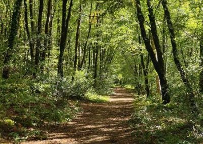
The Ringwood is a mixed woodland forest which follows the river Boro as it meets the river Slaney. It is understood to be a centuries old trail, potentially linking the nearby St. John’s Abbey – founded in 1231 – to its hinterland. To the west, lies Kilcarbry founded by Welsh pilgrim Cairbre in the 5th century, and which later became a flour mill in the 17th century. Also nearby is the Carrig Graveyard, the final resting spot for many of the 1798 Rebellion.
“In the Ringwood”
The yellow Spring on Vinegar Hill,
The smile of Slaney water,
The wind in the withered Ringwood,
Grew dark with ancient slaughter.
My love cried out and I beheld her
change to Sorrow’s daughter.
Thomas Kinsella (1928 – 2021)
Don't Miss...
- Views of River Boro and River Slaney
Useful Trail Information
OSI Discovery Map Series: 69
Grid Reference:
Ascent: 5m
Walking time: 60 minutes
Format: Linear
Surface: Mixed surfaces
Gates/Stiles: No
Start/Finish: Trailhead Car Park
Equipment Recommended: No special equipment required
Other Useful Information
Mobile Coverage:
Picnic Area: No
Public Toilets: No
Facilities: Enniscorthy Town
Dogs: Dogs must be kept under control at all times. You must clean up after your dog if it fouls in a public place.


Getting Here
From Enniscorthy: Ringwood is just 4km from Enniscorthy town centre. In Enniscorthy town, at the roundabout below Enniscorthy Castle, take the exit for the R744 signposted New Ross/Clonroche and continue for 1.2km. Turn left onto St John‘s Villas (L6102) and continue for approximately 2km. To access the Ringwood carpark, please turn off at signpost at 52.473099, -6.573072 and follow lane for 400 metres. The trailhead car park is at the end of the laneway on the right.
From Wexford: Follow the N11 towards Oilgate. At the roundabout after Oilgate village, take the exit R772 toward Enniscorthy town. After 1.8km, turn left and follow the road until you come to a T-junction. Turn right onto the L2045. Take the first right. Continue for approximately 2km through Kilcarbry.To access the Ringwood carpark, please turn off at signpost at 52.473099, -6.573072 and follow lane for 400 metres.. The trailhead car park is at the end of the laneway on the right.

Trail Grades
Trail grades give an indication of what to expect when out on a trail. The grade will give an idea of the level of fitness and ability required to use the trail.
Before attempting a trail, it is important to consider the grading to ensure it matches your ability and level of fitness.
Wexford Walking Trails are graded by Sport Ireland according to their criteria which is explained here.
Multi-Access
Flat smooth trails, suitable for all users including people with reduced mobility, wheelchair users, people with a vision impairment, using crutches, with a buggy, with small children, older people and so on. Normal outdoor footwear can be worn. Source : Sport Ireland
Moderate
These trails may have some climbs and may have an uneven surface where the going is rough underfoot with some obstacles such as protruding roots, rocks, etc. The routes are appropriate for people with a moderate level of fitness and some walking experience. Specific outdoor walking footwear and clothing is recommended. Source : Sport Ireland
Easy
Generally flat trails with a smooth surface and some gentle slopes or shallow steps. These trails are generally suitable for family groups including children and older people. Normal outdoor footwear can be worn. Source : Sport Ireland
Strenuous
These are physically demanding trails, which will typically have some sections with steep climbs for long periods and the going underfoot can be extremely rough including many obstacles. Suitable for users accustomed to walking on rough ground and with a high level of fitness. Specific outdoor walking footwear and clothing required. Source : Sport Ireland